A SaaS platform
to anticipate climate risks
and better crisis management
Combining crisis management
managing the time available to act,
we reduce the impacts of climate hazards
on your organizations and activities
360° Risk and Crisis Management Solutions
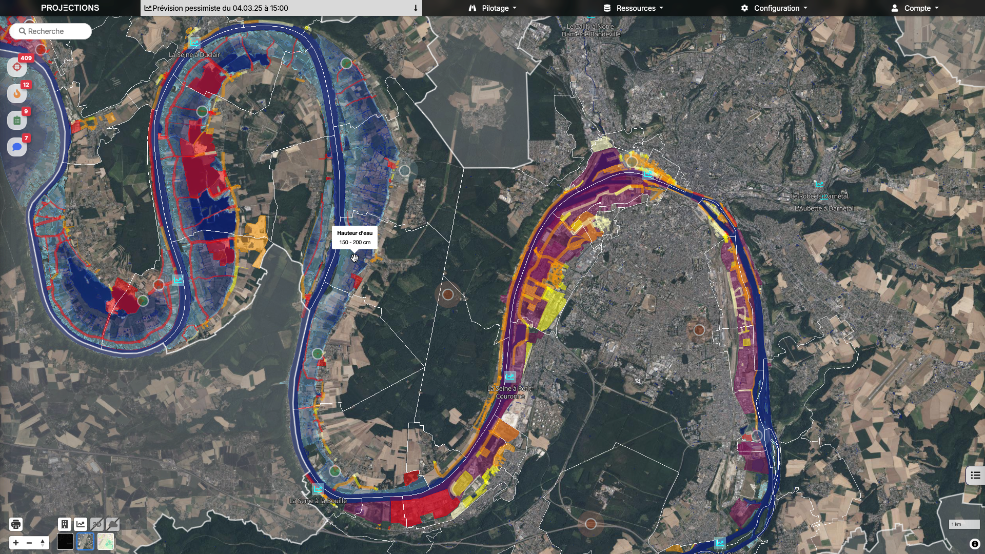
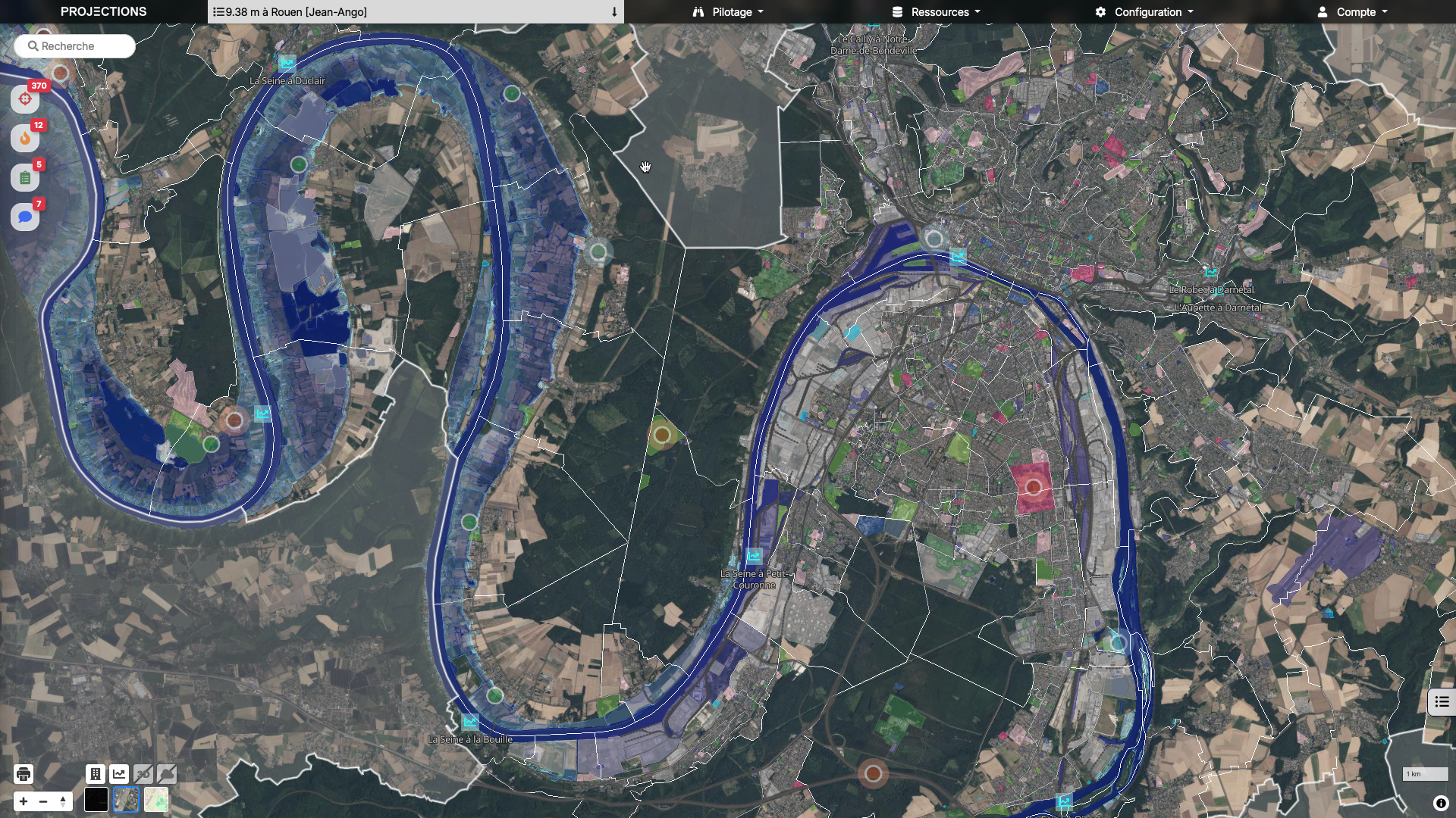
Early Visual Anticipation
Through a set of colors, Projections tells you when and in what order your stakes will be impacted.
In a crisis situation, you know where to act and especially when to intervene to preserve population, goods and activities, before it is too late.
Projections, a powerful platform for anticipate, test, decide


Making risk and urgency visible and understandable
Analyze in seconds the consequences of hazards
Centralize and maintain Critical Data
Back up photos geolocation of the land
Strategically pilot crisis management
Collaborate securely with your partners
Training easily decision-making teams
View available time to act
Estimating the Impacted Population by a crisis scenario
Vous êtes…
PCA
Ensure continuity of your services- Multi-hazard dynamic mapping
- Zoom from macro level to micro
- Identification of criticality thresholds
- Real-time update: forecasts, incidents
- Visualisation and analysis of domino effects
PCS
Maintain your communal backup plan- Multi-hazard dynamic mapping
- Communal Zoom > neighborhood > building > floor
- Secure geolocation of people. vulnerable
- Automated update of critical data
- Uphill field photos and videos
ICPS
Co-build solidarity between municipalities in your territory- Multi-hazard dynamic mapping
- Multi-level visualization
- Coordination with municipalities and prefecture
- Real-time monitoring of communal actions
- Real-time management of resources
Diagnosis of vulnerabilities
Identify your organization's critical points and adapt your plans- Visualisation of exposed areas
- Identification of vulnerability indicators
- Analysis of breakage thresholds
- Cost/impact assessment
- Priority of action
Crisis management exercises
Train your teams through immersive exercises- Rapid development of multi-risk scenarios
- Objective settings, difficulty, unforeseen, duration
- Dynamic contextualization mapping
- Exercise book player, facilitator, observer
- Facilitated multi-stakeholder collaboration
Collaborative workshops
Align different types of actors to build a common vision- Critical network mapping
- Visual indicators of population impact
- Multi-user interface with roles and permissions
- Synchronization of changes for all participants
- Visualisation of infrastructure interactions
THEY TRUST US

BETTER SAFE THAN SORRY
Flood prevention is a critical mission !
%
increase in sinistrality estimated in 2050
Millions of people threatened by floods around the world
Flood casualties in the world in 2022
About Keyros
A few words about the people and vision behind Keyros

Servane Gueben-Venière
CEO
A geographer specializing in risks and crises, Servane develops an innovative approach to anticipation in crisis management.
By integrating the temporal dimension into mapping, it offers a dynamic reading of vulnerabilities and renews decision-support tools.

Nicolas Juguet
CTO
Aeronautical engineer and holder of a master's degree in climate science, Nicolas specialized in the development of complex business applications in different fields.

Eric van den Broek
CMO
Multi-entrepreneur passionate about creating impact products. Eric likes to understand the customer need and find the best answers.
Contact Keyros
Any questions? Need to plan an appointment or a tool demonstration? That's why we're here.